Create a slideshow that shows where you are in your neighborhood, town, state, country, continent, and planet. Each week you’ll work on one or more pages in Kid Pix. When finished, put the pages together to make a slideshow. Click the picture below for a sample of what a finished project will look like.
Tag Archives: maps
Massachusetts Map
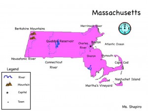
Since you have been studying all about Massachusetts, it landforms, bodies of water, and major cities, today we will create a map in KidPix, complete with a legend and a compass rose.
Map Scale
Map scale is the relationship between distances on a map and the corresponding distances on the earth’s surface expressed as a fraction or a ratio. Today you will use Google Maps at different zoom levels to measure how far 3 inches will take you from a specific point. Use the worksheet to record your location, number of feet traveled, and how long it will take you to walk the distance.
Massachusetts Map
Since you have been studying all about Massachusetts, it landforms, bodies of water, and major cities, today we will create a map in KidPix, complete with a legend and a compass rose.
Want to learn more about our great state? Visit the websites below.
Crack The Code
Today you will work with a partner and visit the National Geographic website Crack The Code. It appears that thieves have stolen some very valuable maps. They fortunately dropped a scrap of paper behind with clues as to the location of the maps. However the clues are in code. Use your knowledge of latitude and longitude along with Google Earth to find the identity of eight cities. The discovery of the identity of all the cities will lead you to the maps. You may not use the Fly to Search, but must spin the globe to find the coordinates. Be sure to turn on the Google Earth grid in the View menu. Please take turns using the mouse. I will hand out a copy of the scrap paper with the clues. Use the back of the scrap paper to write down your answers. Good luck!

Tour the Continents
Today you will learn how to use the placemark feature in Google Earth. Select a pushpin for each of the seven continents and then run a tour of your travels.
Try this game at home:
Massachusetts Map
Since you have been studying all about Massachusetts, it landforms, bodies of water, and major cities, today we will create a map in KidPix, complete with a legend and a compass rose.
Want to learn more about our great state? Visit the websites below.
Massachusetts Map
Since you have been studying all about Massachusetts, it landforms, bodies of water, and major cities, today we will create a map in KidPix, complete with a legend and a compass rose.
Want to learn more about our great state? Visit the websites below.
Landform Flipbook
Today you will begin work on your Landform Flip book. You will be using Google Earth, Powerpoint, and the two Internet sites below for the project. I will demonstrate how to create the book, but I also created the Voicethreads below so that you can review any procedures that you may have forgotten. You will need to create a folder in your documents folder named Landforms. This folder will store your pictures and Flipbook. It will also be helpful to use the F3 key to toggle between open windows.
![]()
Collect all of your pictures before moving on to the PowerPoint Presentation.
![]()
Crack The Code
Today you will work with a partner and visit the National Geographic website Crack The Code. It appears that thieves have stolen some very valuable maps. They fortunately dropped a scrap of paper behind with clues as to the location of the maps. However the clues are in code. Use your knowledge of latitude and longitude along with Google Earth to find the identity of eight cities. The discovery of the identity of all the cities will lead you to the maps. You may not use the Fly to Search, but must spin the globe to find the coordinates. Be sure to turn on the Google Earth grid in the View menu. Please take turns using the mouse. I will hand out a copy of the scrap paper with the clues. Use the back of the scrap paper to write down your answers. Good luck!


